Although the King County property records site is great for old photos of existing buildings, it sadly doesn’t include photos for buildings that once existed on a property but have since been torn down. So last week we took an afternoon trip over to talk with the helpful folks at the Washington State Archives in Bellevue, and did some research on the blocks around 23rd & Cherry.
Here’s the southeast corner of that intersection, the current home of the Garfield Community Center. This photo from 1937 appears to prove the adage that every corner in the neighborhood used to have at least one gas station, which in this case is a Gilmore Red Lion service station where you can get a flat tire fixed for 40 cents. The view is looking east across 23rd: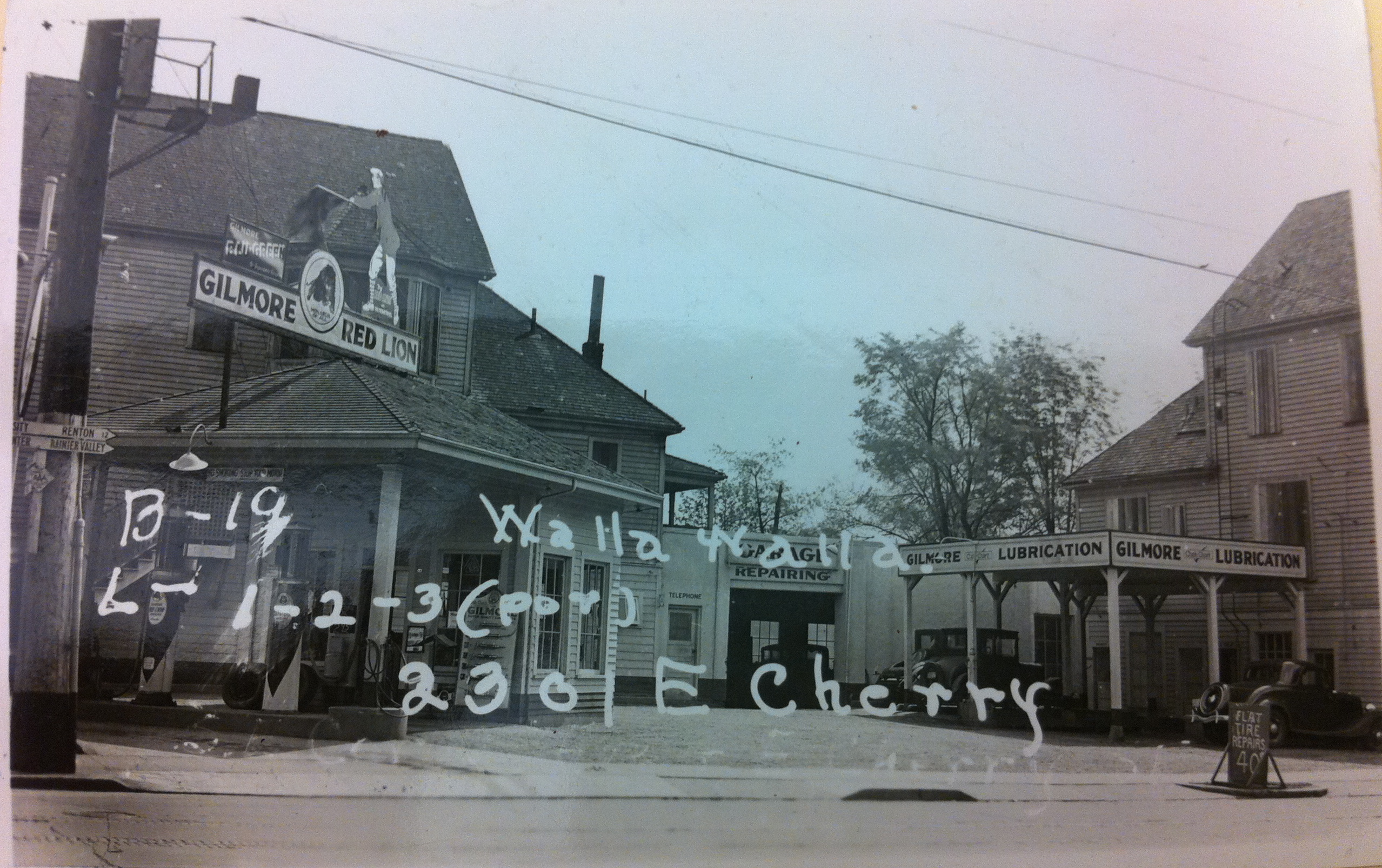
This second view in 1958 takes away a lot of charm and all of the gas station’s old neighboring buildings, looking south across Cherry with Garfield in the far background: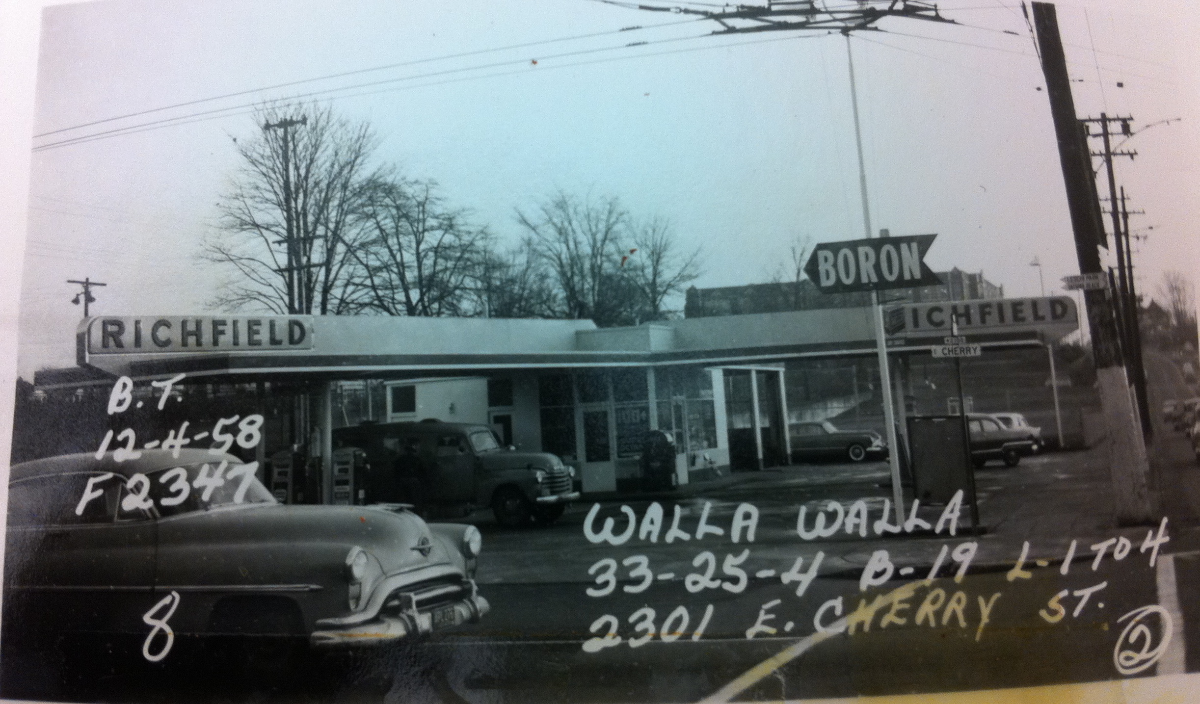
Here’s the current view via Google Maps:
Why do the photos say Walla Walla on them?
Walla Walla was the name of the subdivision. The photos also say B-19 for Block 19, and L 1,2,3 or L 1-4 for Lots 1,2, and 3, or Lots 1-4. The Walla Walla subdivision was platted in 1890, and took in 22 blocks, roughly from 20th to 24th, and extending several blocks both north and south of Cherry. Originally this land was owned by Henry Yesler.