More and more people are talking about running the First Hill Streetcar along 12th Ave. In addition to all of the development and ridership reasons, a simple argument for it may be that 12th once had a streetcar, but now doesn’t even have a bus route that serves it.
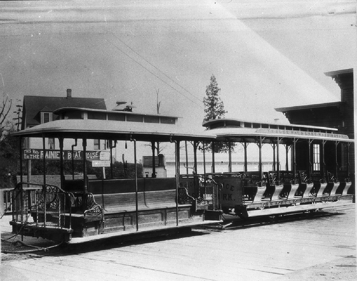
Back in the day the Central District was one of the best neighborhoods in the city for transit. A mix of cable cars and streetcars connected us to downtown, the U-district, the lake, and south Seattle. If you’re ever walking around the neighborhood and see a street that seems unusually wide (19th north of Union, 21st between Jefferson & Cherry, Columbia between 12th & 14th), or cuts at an odd diagonal (Yakima Ave S), it’s probably because that was an old streetcar route.
I consulted the 1912 Kroll map of Seattle at the library to come up with this map of historic streetcar routes in the neighborhood:
View Historic Streetcar Routes in a larger map
The city’s streetcars were originally built and operated by private companies. In 1919 they started to lose money, and mayor Ole Hanson bailed them out by purchasing the streetcar network for $15 million, three times more than its market value. A supreme court decision in 1922 further hobbled the system by ruling that the city could only use farebox revenue to maintain it and service the large debt, and things slowly started to fall apart.
It all came to an end in 1939 when the city obtained a federal loan to pay off the streetcar debts and switch to buses. The last trolley ran in 1941, and all of the old tracks were dug up and sold as scrap.
So how about if in addition to a streetcar on 12th, we replaced the #48 with frequent streetcar service along 23rd?
It would be great if the street car ran down 12th ave, probably would get more people to China Town and give 12th a needed facelift. I’m all for it!
I could swear that I have read in a couple of places in the past that the Yesler Way Cable Car went one way on Yesler Way and returned back the other direction along Jackson St. Did you come across any evidence of that?
Yes – the 1912 maps actually showed tracks on Jackson with a connection to Yesler at 31st, but I think they may have been out of use by then, as this site says that it was switched to bi-directional travel on Yesler in 1900.
Please note that streetcars were able to make it up Pike street as well as Madison. What is the logic that they can’t do hills, that the grades are to steep. What is now the route 10 went up Pike to 14th and then turned onto 15th at Mercer if I recall correctly.
One the reasons Stone & Webster was losing money on the cars was the upkeep of the track and the street it ran on. The city didn’t keep up the street car tracks and they were usually unpaved, making them difficult for wagons and cars to cross. The city took over the lines after the Seattle General Strike when S&W wanted to bail having already lost the electric franchise to City Light. The remains of Stone and Webster in this area is PSE.
However let me say that trolley buses are cheaper, faster and more efficient than street cars. There is a reason that Seattle went to trolley buses in 1939 rather than refurbish its decrepit street cars. They don’t need to have both track and overhead maintained, they can move around stalled vehicles or accidents and if Metro equipped them like Vancouver does with an small diesel motor they could be rerouted around fires and closures unlike streetcars which will grind to a halt the moment a fire hose is laid across the track.
Want to know where streetcars ran in Seattle get a copy of Leslie Blanchard’s Street Railways of Seattle with the maps in the back. Not a rare book but out of print.
“Please note that streetcars were able to make it up Pike street as well as Madison. What is the logic that they can’t do hills, that the grades are to steep.”
Note that the three steep routes (James, Madison, Yesler) are marked on Scott’s map as cable cars. Traction was provided by the cars gripping a constantly moving underground steel cable that was accessed by a slot between the rails (think San Francisco cable cars: the “driver” operates a lever that adjusts the grip on the cable) and hence the cars were pulled up the steep hills by the cable. I don’t know how they managed to brake going down steep hills: I suspect traffic was lighter and it was less of an issue than it might be now.
Streetcars get electric power from overhead lines and use electric motors to drive their metal wheels. It’s the limited friction of metal wheels on metal rails (especially in the rain) that limits the steepness of the hills they can climb (to ~ an 8 to 9% grade, I read recently). BTW it’s the limited friction that also makes rail transportation so efficient!
Could you please quantify ‘more and more’ ? :)
More and more people are talking about running the First Hill Streetcar along 12th Ave.
Cable cars were gone before the end of the streetcar era in Seattle. I’m well aware of the difference between cable cars and streetcars though streetcars were cable assisted on Queen Anne Ave N. till the end of the streetcar era in Seattle.
I don’t think there was a big difference between the end of the cable cars and the streetcars.
The cable-car-guy site has the following dates for the cable cars’ transition to buses:
Yesler Way: August 10, 1940
James St. (aka Union Trunk Line): February 17, 1940
Madison St: April 14, 1940
Although evidently the Madison route had been shortened several times before that, to 21st in 1910, Broadway in 1911, and back to 14th Ave in 1913.
When I lived in Seattle, up to 1954, the University Bridge had a track in each direction in the outside lane offsets used to avoid bridge hardware about halfway across. Were those ever removed or paved over?
Seems to me they might be bike lanes now, but I haven’t been there for a while. Anybody else know?
Indeed, they are bike lanes. In fact, because of the way the bridge was designed to accommodate the tracks, the University Bridge is really the only bridge in the city that is truly bicycle-friendly.