
Here’s the latest from the National Weather Service — we’re now at ‘Special Weather Statement’ status:
…SUB-FREEZING TEMPERATURES TO LAST THROUGH THANKSGIVING
MORNING…
…TRANSITION TO A MORE TYPICAL WEATHER PATTERN THANKSGIVING
AFTERNOON…THE VERY COLD AIR MASS OVER WESTERN WASHINGTON WILL KEEP
TEMPERATURES BELOW FREEZING THROUGH THANKSGIVING MORNING. THE
COLDEST TEMPERATURES WILL OCCUR THIS MORNING WITH SOME LOCATIONS IN
THE SINGLE DIGITS. THERE IS A CHANCE WITH THE SNOW COVER THAT THE
COLDEST LOCATIONS IN WESTERN WASHINGTON COULD BE BELOW 0 THIS
MORNING. SEATTLE-TACOMA AIRPORT HAS ALREADY SET A NEW RECORD LOW
WITH 14 DEGREES.HIGHS TODAY WILL WARM INTO THE 20S AND LOWER 30S WITH SOME MID AND
HIGH LEVEL CLOUDS MOVING THROUGH THE AREA. THE CLOUDS WILL INCREASE
TONIGHT WHICH WILL PREVENT TEMPERATURES FROM DROPPING AS LOW AS THEY
WILL THIS MORNING. MOST LOCATIONS WILL BE IN THE 20S OVERNIGHT
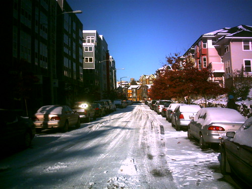
TONIGHT.ICY ROADS WILL BE A PROBLEM THROUGH THANKSGIVING MORNING. WITH
TEMPERATURES REMAINING BELOW FREEZING COMPACT SNOW AND ICE WILL
REMAIN ON MANY ROADWAYS. FOR FREQUENTLY TRAVELED ROADS…FRICTION
FROM TIRES MAY TEMPORARILY MELT THE SNOW AND ICE ON THE ROAD TODAY…
ONLY TO HAVE IT RE-FREEZE AGAIN TONIGHT.A WEAK WARM FRONT WILL MOVE BY TO THE NORTH ON THANKSGIVING…
BEGINNING THE TRANSITION TO WARMER WEATHER. THERE IS A CHANCE OF
PRECIPITATION ON THANKSGIVING…BUT THERE IS STILL SOME UNCERTAINTY
AT THIS POINT HOW EARLY ANY PRECIPITATION WILL REACH THE AREA.
PRECIPITATION FALLING DURING THE MORNING WILL MOST LIKELY BE
SNOW…BUT ACCUMULATIONS WILL BE VERY LIGHT. TEMPERATURES WILL RISE
TO ABOVE FREEZING BY THANKSGIVING AFTERNOON CHANGING THE
PRECIPITATION TYPE BACK TO RAIN.A COLD FRONT WILL BRING RAIN AND MOUNTAIN SNOW TO THE AREA THURSDAY
NIGHT WITH SNOW EXPECTED IN ALL OF THE PASSES.FOR AREAS THAT HAVE SEVERAL INCHES OR MORE SNOW ON THE
GROUND…THE RAIN THURSDAY NIGHT WILL MAKE ROAD CONDITIONS RATHER
MESSY. PONDING OF WATER ON THE ROADS AS THE SNOW MELTS MAY CAUSE
HYDRO-PLANING PROBLEMS FOR VEHICLES.A SHOWERY WEATHER PATTERN WILL PERSIST THE REST OF THE
THANKSGIVING HOLIDAY WEEKEND. RAIN SHOWERS OVER THE LOWLANDS WITH
SNOW SHOWERS AFFECTING THE CASCADE PASSES.
- CHS posted a long list of Seattle city service updates including notes on SDOT’s continued efforts in last night’s update. Here’s an abbreviated version from their Twitter account this morning: “SDOT continues working roads w/ snow fleet. Today will work to prevent refreezing and address trouble spots on Level 3 routes.”
- Here’s the map Andrew Taylor shared with us last night of SDOT street closures:
View Street closures 11/23/10 in a larger map
- Metro is again on snow route status but says there will be fewer canceled routes today. Check for updates and find your snow route here http://metro.kingcounty.gov/up/rr/adverseweather.html
- Seattle public schools are closed.
- Sidewalks: SDOT is reminding everybody of the need to clear your sidewalk.
- Airport: From reports, sounds like Sea-Tac is running well and airlines have the staff they need to maintain full service. Getting there still requires patience. Bus service is a more consistent experience at this point if you are headed for light rail. Driving? You can but if you’ve never dealt with icy conditions, you might want to splurge on a cab. Residential streets are still ice and snow covered but the main arteries are fully navigable and in decent shape except for the closures noted above. I-5 to the airport is open and moving but continuing icy temperatures mean you’ll need to keep it slow and steady.
7:20 AM: #43 trolleys just passed in both directions at 20th / John
7:27: saw a #90. No 8’s yet.
Any reason light rail is inconsistent at this point? I’m just having trouble finding out if it’s closed or not on the King County metro page – their alerts only have buses as far as I can tell.
Light Rail is covered on the Sound Transit page:
http://www.soundtransit.org/Riding-Sound-Transit/Rider-Alert
Took the 14 from 23rd down jackson this morning and all looked good! Can’t say the same for the Kent area–horrible ice!
I saw a #8 this afternoon turning eastbound on E Union from SB 23rd Ave