
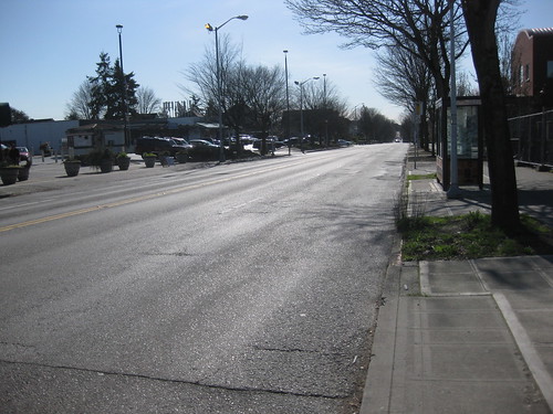
We got a press release from SDOT yesterday detailing the performance results after Stone Way was narrowed up in Fremont/Wallingford. There was much controversy at the time that project was proposed in 2006, with area businesses and residents fearing long backups and more congestion.
But two years after the project was completed, the city has data that shows the reduction to two lanes from four was a big success:
- Motor vehicles now travel at speeds nearer the legal limit;
- Total collisions dropped 14 percent with injury collisions down 33 percent;
- Pedestrian collisions declined significantly;
- Bike trips increased 35 percent but collisions per bicycle trip have declined; and
- Volumes show the roadway still easily accommodates motor vehicle traffic.
Could this be a model for our own 23rd Avenue?
According to city data, Stone Way served 15,200 vehicles per day in 2008. That compares to 15,100 vehicles per day on 23rd Avenue here in the Central District (last measured in 2006).
That would appear to suggest that it’s an option. Stay tuned for more data next year when the city studies adding off-peak parking to 23rd.
I believe a road diet would work very well for 23rd, perhaps stretching from East John all the way down to South College St. The four-lane 23rd is very narrow, and there are many blind spots at side-street intersections where you can’t see traffic in the right-hand lane until you are, in fact, in the right-hand lane. Having a two-lane road with a reversible lane in the middle (or just at certain intersections) with parking/bike lanes on either side seems like a great option. It will naturally calm the traffic, more drivers will naturally obey the speed limit and it will greatly increase safety. More pedestrians will be able to cross the street safely and legally as well if we mark crosswalks.
I’ve noticed that most of the skepticism about “road diets” revolve around the concern that it will cause traffic backups and congestion. It’s pretty easy to assume this because you look at four lanes of traffic and imagine that condensed into two lanes. However, if the traffic is being funneled down through just the one lane from the previous traffic light, then only the one lane of traffic will be approaching the next traffic light. Synchronize the lights properly and there won’t be any backups. The ideal candidate for a road diet carries 12-18,000 cars per day. 23rd carries 15,000.
Sure, traffic might flow a little more slowly. You won’t be able to zoom past cars obeying the speed limit anymore. The buses that run down 23rd might have to take an extra moment or two to merge back into traffic. But this will make buildings in the area more desirable, as they won’t be next to what is practically a highway. This will make our neighborhood safer.
Plus, this opens up the possibility of a streetcar route along 23rd. Now who isn’t down with that?
Couldn’t have said it better myself. The vehicle volumes are in the perfect range for a sucessful road diet, as shown in the Stone Way case, and bike lanes would be consistent with the Bike Master Plan.
Let’s narrow the &%#$ out of Rainier Ave. S. while we’re at it, and put in some bike lanes. That street is the most obvious cycling route south of I-90, but it’s completely inhospitable to anyone not encased in 2000 lbs of steel at the present. I’m talking about pedestrians here, too.
I just worry that this will push more big truck traffic to the north part of MLK, which is already two lanes and is all residential except for a few spots at Union and at Cherry. People already treat that stretch as a speedway.
23rd is our main arterial in the CD- it isn’t just another street for jogging north on.
Props to SDOT for posting performance results on Stone Way- it’s a nice drive up there in Wallingford with one lane each direction (1×2) flaring out to wider 2 lane (2×2) intersections at the busy spots- maybe it’s a template. But how much of that 15,000 capacity is cars driving the length of Stone way vs. cars just tacking for a block from 40th to Bridge?
How valuable is the 23rd vs. Stone Way comparison?
23rd carries a lot of traffic all the way from the Montlake neighborhood down to Rainier Valley. Are other factors like bus usage similar between the two routes? How about heavy trucks- the kind of vehicles we’re gonna be stuck behind when they cut our road down to one lane?
Thanks for the post
I think that Metro has to be involved in the conversation; Stone Way carries very little bus traffic by comparison to the 43/48 combo on 23rd (basically Stone Way is a cut-over/through for several Metro routes between 35th & 45th on their way east/west), while the 43/48 are workhorse routes).
Having said that, there are plenty of approaches that could make transit work well in a road diet environment.
I don’t believe SDOT has actual truck counts for either Stone or 23rd, but I would love to be wrong :)
In a road diet configuration, with only one lane each way, how do buses merge back into traffic? 23rd is currently four traffic lanes; if you re-stripe it for two traffic lanes plus a turn lane, you only have a half-lane on either side for buses to pull over, which isn’t enough room. You’d either have to take away sidewalk space (which is extremely thin on much of 23rd) or do bus bulbs and have the bus stop in-lane. I’m good with that answer, but I’m not sure everyone else is :)
Stone Way goes from one lake to another. It’s not a serious road. Plus, it’s the north end. No comparison.
your right it is the north end. We jus a buncha dum crackheads hoo don dezerve fair treetment oh a good enviormnt. I say bring back the rh thompson freeway, yo soo right apples to oranges.