
Today the city announced the release of new citywide walking maps that can be used to plan your fall foot-based adventures.
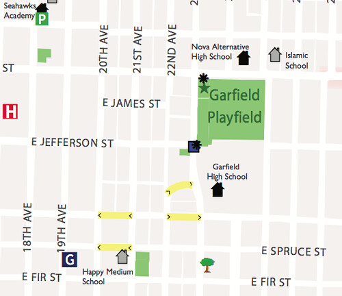
Although we still prefer the awesome Feet First map, this one has some useful features such as a marking for steep slopes and some time estimates for select paths around the neighborhood. But note that some of their info is woefully out of date (see inclusion “Seahawks Academy” and the lack of our 27th & Cherry Heritage Tree).
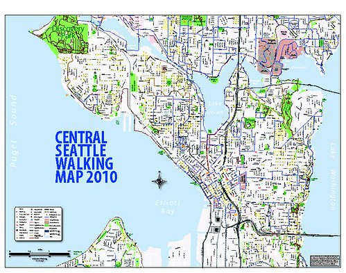
The Central Seattle version of the walking map is attached at left, or go to the city’s site for the whole thing.
and things that you’d like to see on the next version of the Feet First map of the CD, please drop us a line at info @ feetfirst.info
Thanks!
i love these new SDOT walking maps! so great! oops about the out of date info … can be fixed next time around.
The Feet First maps are clearer in purpose and use. The walking routes on the SDOT are impractical for getting from on destination to another and are obviously intended mainly for recreational walking, right? Why no north-south routes or very few? And, I can resist mentioning my pet peeve. Did anyone note the the difficulty of families living between Madison and Jackson and between 12th and 23rd would have it they attempted to walk to assigned schools?